

Aerial photography represents a fascinating blend of technology and artistry.
It leverages drones, airplanes, helicopters, or other aerial vehicles equipped with camera equipment to capture ground scenes from elevated perspectives.
With technology's relentless evolution and a significant drop in costs, aerial photography has emerged as a pivotal tool across numerous sectors, including geographic information systems, urban planning, agriculture, real estate, tourism, and more.
1. Historical Evolution of Aerial Photography
The origins of aerial photography trace back to the late 19th century when photography was still in its infancy. Early pioneers of this art form used hot air balloons and airships fitted with rudimentary camera equipment for aerial imagery.
As aviation technology advanced, aircraft became the primary tool for aerial photography. Commercial aerial photography took flight in the early 20th century as photographers began using airplanes to capture cities and geographic features for cartography and urban planning.
With the advent of digital photography, aerial imaging emerged as an independent field, while the rapid ascent of drone technology further broadened its horizons.
2. Aerial Photography Technology
Camera Equipment: Aerial photography relies on high-resolution cameras or specialized camcorders, some of which are equipped with professional-grade lenses to ensure the capture of high-quality photos and videos.
Aircraft: Aerial photography encompasses various aerial platforms, including manned aircraft, helicopters, and drones. In recent years, drones have gained immense popularity due to their affordability, ease of operation, and capability to access hazardous or remote locations.
Remote Control and Navigation Systems: UAVs (Unmanned Aerial Vehicles) and other aerial photography equipment often incorporate advanced remote control and navigation systems to guarantee safe flight operations and precise image acquisition.
Geographic Information System (GIS): Integration with GIS technology is essential for many aerial photography projects. This integration allows for the amalgamation of aerial imagery with geographic data, facilitating applications like map generation, land management, and urban planning.
Image Processing Software: Post-processing is frequently required to enhance image quality, merge multiple images, and generate digital elevation models. Professional-grade image processing software plays a pivotal role in this phase.
3. Applications of Aerial Photography
Geographic Information System (GIS): Aerial photography serves as a cornerstone for digital mapping and spatial analysis. It finds utility in diverse fields such as land surveying, natural resource management, urban planning, and environmental monitoring.
Real Estate: Aerial photography is widely employed in the real estate sector to showcase properties' visual appeal and provide prospective buyers with comprehensive insights. Furthermore, it is instrumental in monitoring construction progress and assessing building maintenance requirements.
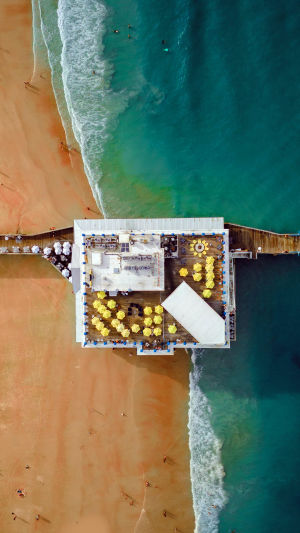
Tourism and Media: The tourism industry benefits immensely from aerial photography by showcasing breathtaking aerial vistas. It is also integral to media projects, including tourism promotion, documentary production, and advertising.
Agriculture: Agriculture leverages aerial photography for monitoring farmlands, identifying pests and diseases, crop management, and efficient water resource allocation to bolster agricultural productivity.
Aerial photography stands as a formidable technology that has revolutionized numerous sectors. With technology's relentless progression, aerial photography is poised to play an increasingly pivotal role, ushering in innovative applications and offering unparalleled perspectives on the world.
Whether employed for commercial or non-commercial purposes, aerial photography is reshaping our perception of the world, unveiling unique vantage points and boundless opportunities.